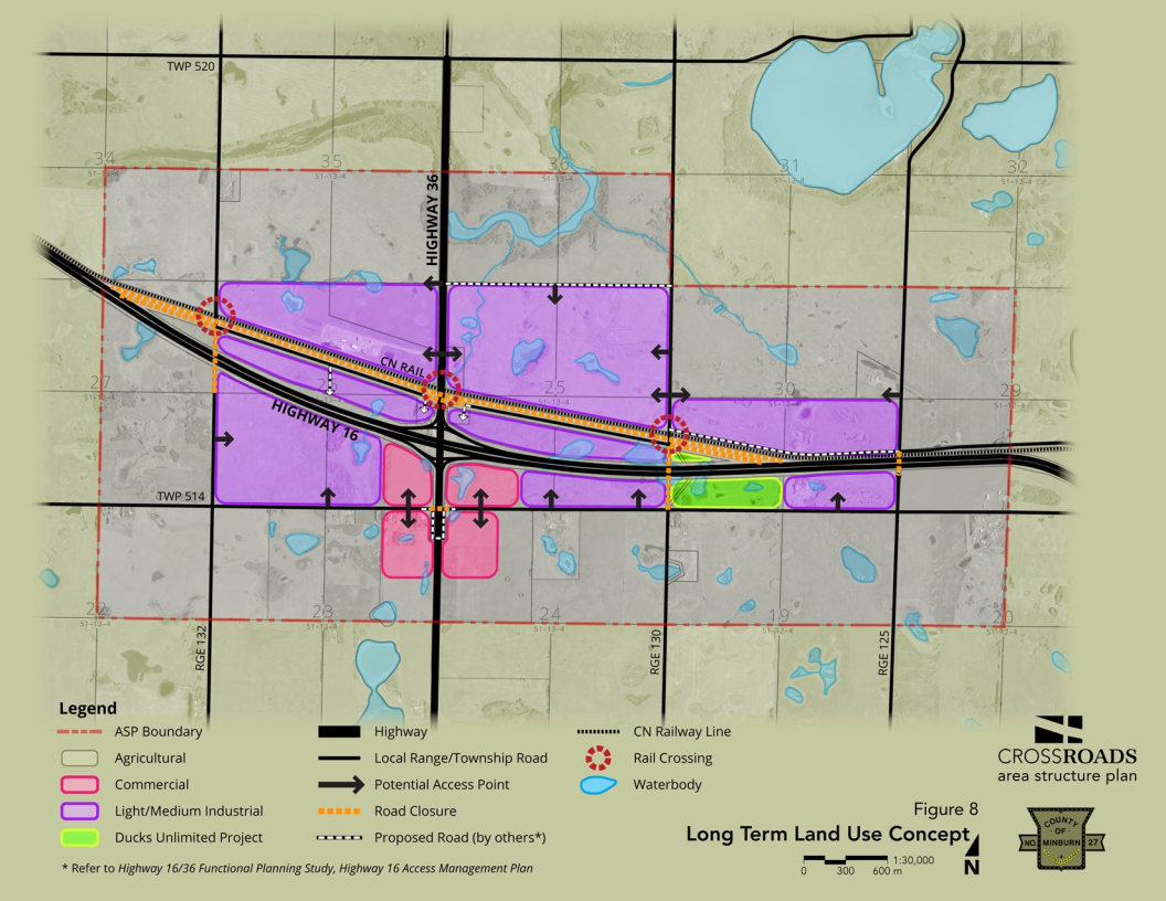
Crossroads Industrial Park
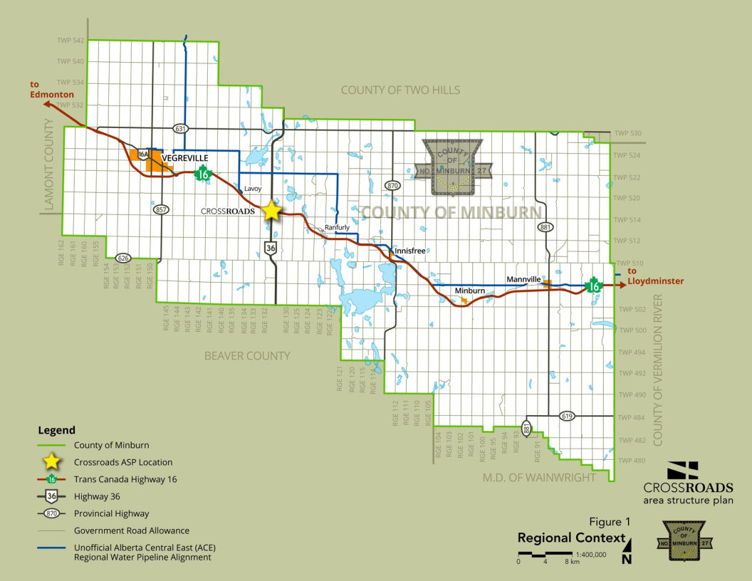
Situated less than 20 minutes east of Vegreville, Alberta, approximately 1,360 acres (550 ha) of land has been identified for future light and medium industrial development (purple lands below). A further 120 acres (48.5 ha) of land has been identified for future commercial uses (pink lands below)
Highways 16 and 36
Highway 16 (Yellowhead) is a major east-west corridor, linking the County of Minburn and Western Canada to the Port of Prince Rupert and destinations beyond.
Highway 36 (Veterans Memorial Highway) is part of the Eastern Alberta Trade Corridor (EATC) and CANAMEX transportation corridor linking Canada, the US, and Mexico. It is designated to serve intra-provincial travel needs, forming part of the provincial High and Oversize Loads Corridor with access to Alberta’s Cold Lake and Athabasca oil sands development areas.
Roads/Rail
Highway 16 is a four-lane, divided high-way with a posted speed limit of 110 km/hr. The intersection of Highways 16 and 36 in the County has been identified by the Province of Alberta as a future interchange location within an approximate 20-year horizon. the interchange footprint, right-of-way requirements, access management issues, and detailed functional plans have been addressed by the Province’s planning documents:
- Highway 16 Freeway Corridor Management Study; and
- Highway 16:24/26 & Highway 36:18/20 Interchange Southeast of Lavoy Functional Planning Study
Highway 36 at this location is a two-lane, undivided highway with a posted speed limit of 100 km/hr and intersects Highway 16 just south of the Canadian National Railway (CNR) line.
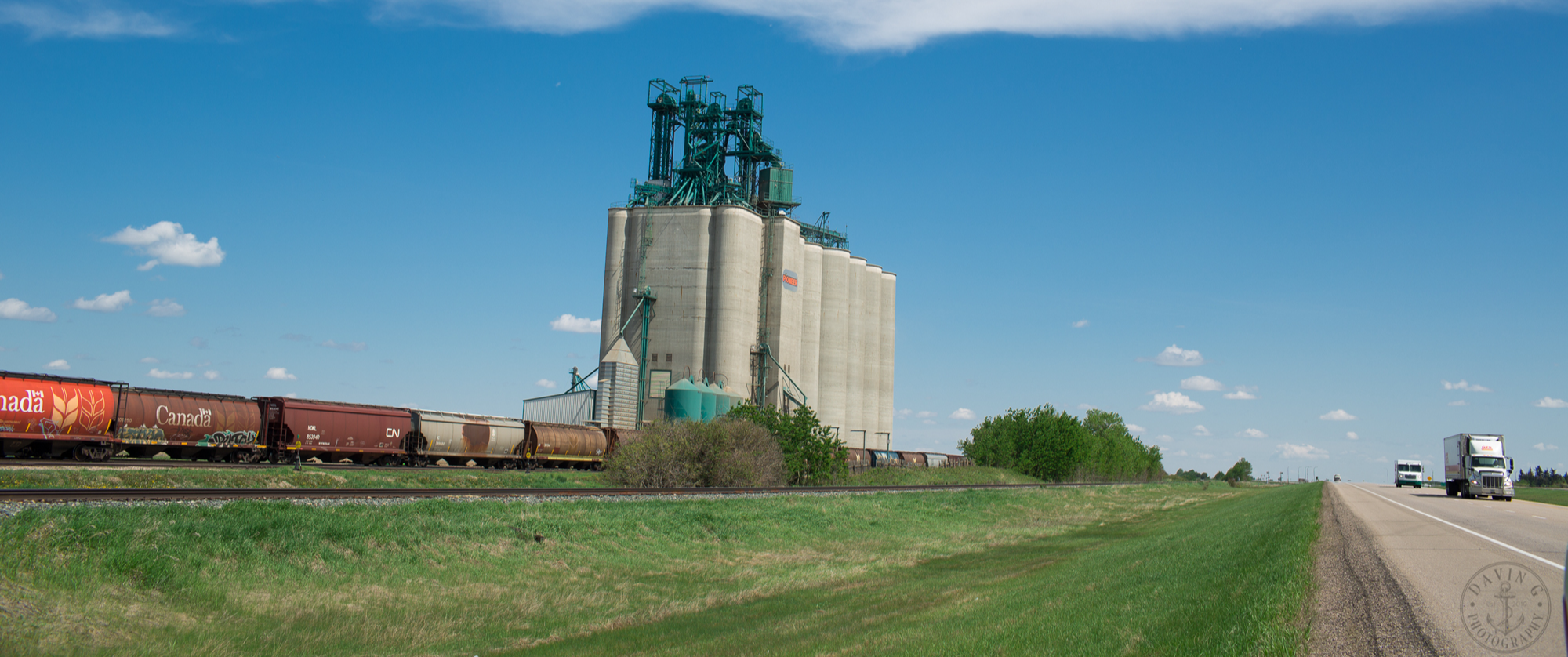
The CNR line runs north of and parallel to Highway 16, offering potential advantage to prospective developers. There is 25 m separation distance between Highway 16 and the CNR line.
Zoning
The existing land use district, or ‘zone’, within the ASP boundary is A – Agricultural District. This means that prior to new development approval (and depending on the proposed use), land may have to be redistricted, or rezoned, to either RI – Rural Industrial District or RC – Rural Commercial District.
Redistricting land requires amending the County Land use Bylaw, a process that requires three readings of the proposed amending bylaw plus a public hearing prior to second reading. The time frame for redistricting applications can be between 2 – 4 months, depending on a number of factors.
Download the Application to Amend the LUB here.
For more information, please contact the County’s Planning and Community Services department.
_Web.png)
Servicing
Servicing in the near term will be by independent water and wastewater systems, or by scalable communal servicing systems. A regional water line is located about 4 miles (2.5 km) north of the Crossroads ASP area.
Existing 3-Phase electrical capacity is 1 MVA.
Stormwater management will be required to balance pre-and post-development runoff rates.
Subdivision
Subdivision of land requires approval from the County’s Subdivision Authority, which consists of all members of Council. Once a complete application for subdivision has been received by the County, the Subdivision Authority has 60 days to prepare a decision. Visit the Subdivision page for details.
Wetlands
Numerous wetlands exist within the ASP boundary. Development constraints may exist related to the Province claiming ownership of permanent and naturally occurring wetlands in the ASP area. Developers are advised to consult a qualified environment professional in the early stages of a project to confirm if a Provincial permitting process may be triggered. Further, Ducks Unlimited (green lands seen on second photo on page) has identified one project within the ASP boundary and should be advised of any potential developments that may impact the existing, or proposed future, project.
Download the Crossroads ASP here
Download the Crossroads Brochure here